Essex - Jun. 10, 2020:
The Essex Region Conservation Authority advises that the previously issued shoreline flood watch remains in
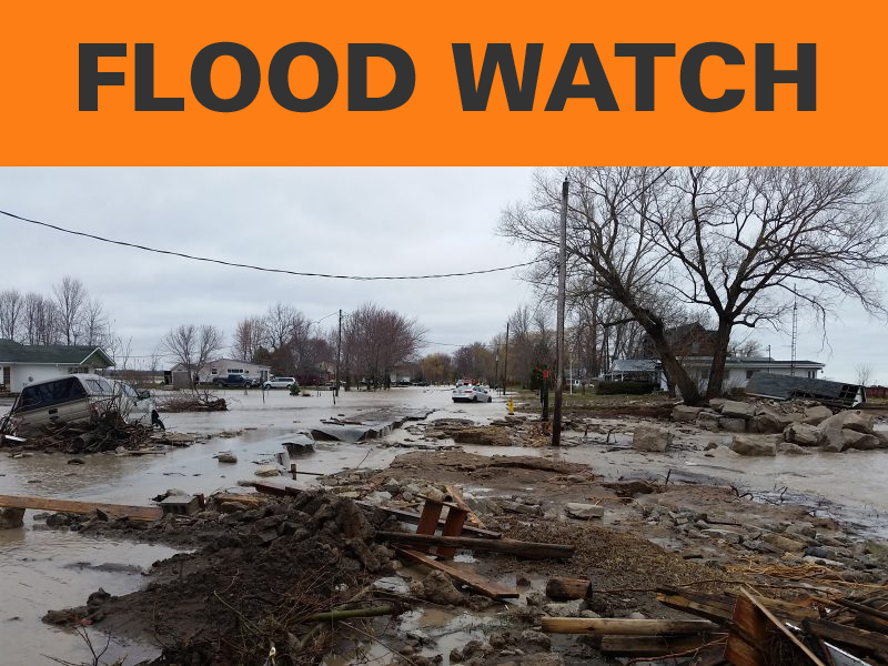
effect as a result of high static (calm) great lakes water levels. In addition to this, forecasts are predicting
moderate-to-strong winds from the south shifting southwest to west overnight into Thursday morning. Wind
speeds could reach up to 40 km/hr with very gusty conditions also possible. These conditions bring an
elevated risk of flooding and nearshore erosion for the shoreline areas along Lake Erie including south Pelee
Island and islands within the western basin of Lake Erie. In addition to this, forecasts are also predicting
significant rainfall as a result of potential thunderstorms across the Essex Region this afternoon and evening
with amounts up to 40 mm being a possibility. It is expected that areas receiving up to 40 mm may be
localized; however, should the spatial distribution be substantial, then some inland watercourses may be
affected and swell as a result of downpours. Areas may also experience standing water, which present their
own unseen hazards. Note that thunderstorms can bring rapidly changing wind conditions and can affect
shoreline conditions. People should pay close attention to their local conditions.
People should take extra caution to avoid areas where flooding is occurring as well as rivers, streams, and
shoreline areas during significant rainfall and wind/lake events. The combination of slippery banks, waves,
waves overtopping shoreline structures, and fast moving water can be dangerous. Standing water can also
present its own unseen hazards. Children, pets, and livestock should be kept away from flowing or standing
water as well as shoreline areas.
The Municipality of Leamington should continue to monitor the flood control dykes in the Southeast
Leamington Area, including the Mersea Road 1 Dyke and the Marentette Dyke. The Municipality of
Leamington and the County of Essex should continue to monitor the shoreline area along Point Pelee Drive.
The City of Windsor should continue to monitor water levels along the flood control dykes within the Little River
Drain corridor. The Township of Pelee should continue to monitor areas along the shoreline that have
experienced significant erosion, such as the West Shore Road and McCormick Road. Community Flood
Coordinators and municipal staff are encouraged to continue the monitoring their respective shoreline areas.
Essex Region Conservation Authority officials will continue to monitor conditions and advise accordingly.
The standing high water flood watch message is included below for reference and remains in effect through
June 2020.
The Essex Region Conservation Authority advises that, due to the current high static (calm) water levels in
Lake St. Clair, the Detroit River, and Lake Erie, the region remains under a Flood Watch for all shoreline areas
including Pelee Island and islands within the western basin of Lake Erie. Preliminary information indicates that
both Lake St. Clair and Lake Erie have set new record highs for the month of May surpassing last year’s
record setting levels. At these current record setting levels, Lake St. Clair and Lake Erie are roughly 85 cm and
75 cm, respectively, above long term average levels. This continues to elevate the risk of flooding and erosion
near our shoreline areas.
High lake levels continue to cause downstream reaches of major tributaries to remain elevated. With
tributaries full of lake water, it reduces their capacity to handle rainfall and has the potential to cause local
rivers, creeks and streams to swell and potentially spill into low-lying areas under more frequent rainfall events
than normal.
This message will remain in effect for the month of June. Officials will continue monitor conditions and
forecasts and issue area-specific messages based on available information. As shoreline conditions can
sometimes change quickly, our office is advising residents to monitor local conditions and to take proper
precautions, especially as winds reach sustained speeds of roughly 30 km/hr. In general, areas of concern are
described below with respect to general wind directions over the lakes.
Northeast/East Winds
– Lake St. Clair shoreline from Windsor to Belle River
– Lake Erie shoreline including Pelee Island
– Detroit River shoreline
North Winds
– Lake St. Clair shoreline
Northwest Winds
– Lake St. Clair shoreline from Belle River to Tilbury North
South/Southwest/Southeast Winds
– Lake Erie Shoreline including south Pelee Island
West Winds
– West shoreline of Pelee Island
|